


|
|||
|
Discover the origin of the ‘Aquae Patavinae’ and the history of the Euganean thermal area...
|
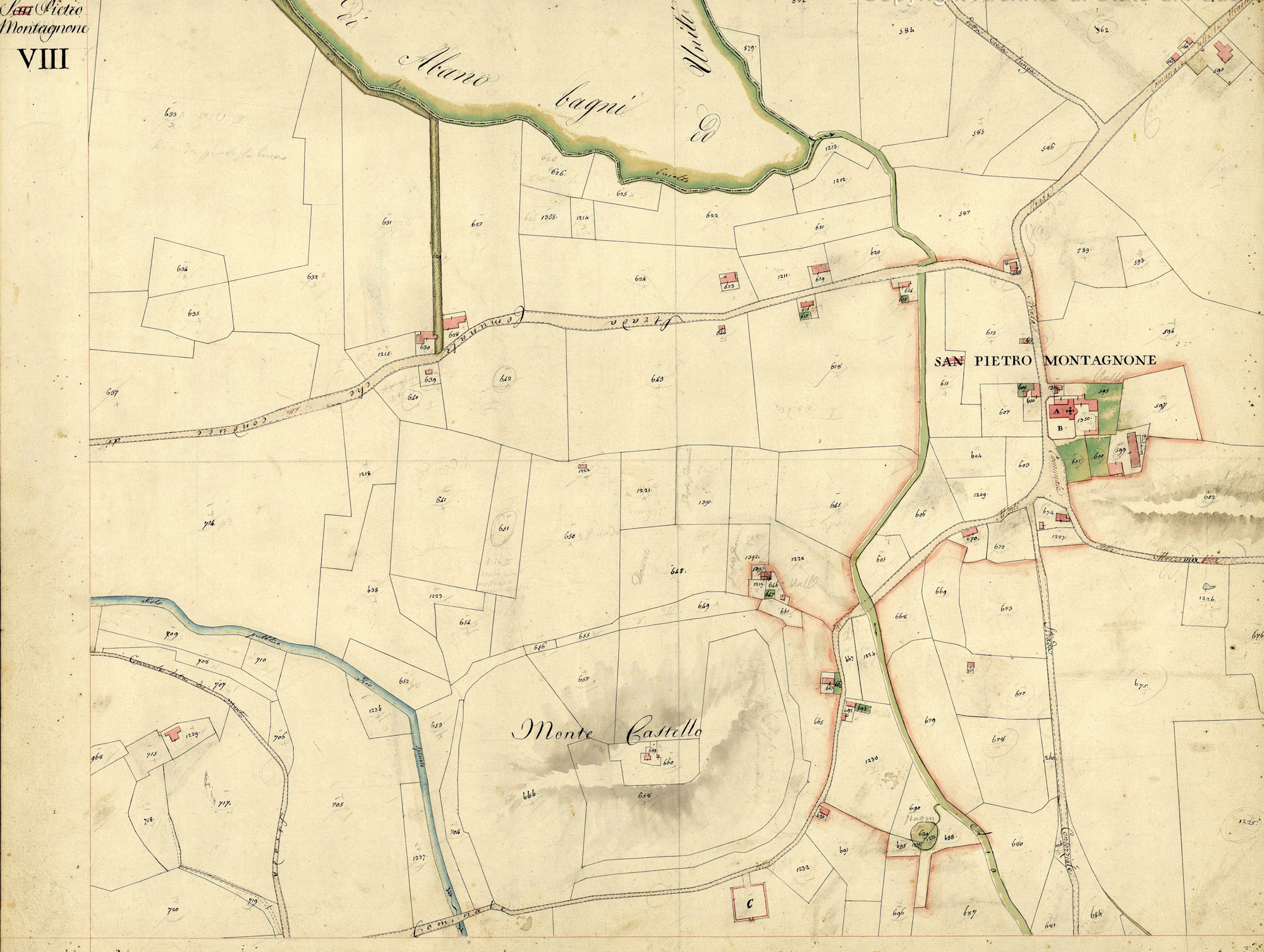
Cartographic dossier n°7CATASTO AUSTRIACO – MAPPA DEL COMUNE CENSUARIO DI SAN PIETRO MONTAGNONE CON MONTEGROTTO, DISTRETTO DI BATTAGLIA, PROVINCIA DI PADOVA (1834)The Austrian Land Register was based on the same parameters of the preceding Napoleonic Land Register, despite some modifications in the “sommarioni” and in the attached reading tools. La riproduzione del documento sottostante è stata eseguita dalla Sezione di Fotoriproduzione dell’Archivio di Stato di Padova su concessione del Ministero per i Beni e le Attività Culturali, Archivio di Stato di Padova n. 07/2013 del 22/05/2013 Prot. n. 01616 Cl. 28.13.07/1.2  Mappa del territorio di San Pietro Montagnone – Catasto Napoleonico (1810)…  Topografia delle fonti termali di S. Pietro Montagnon (1834)… |
||
|
|
|||