


|
|||
|
Discover the origin of the ‘Aquae Patavinae’ and the history of the Euganean thermal area...
|
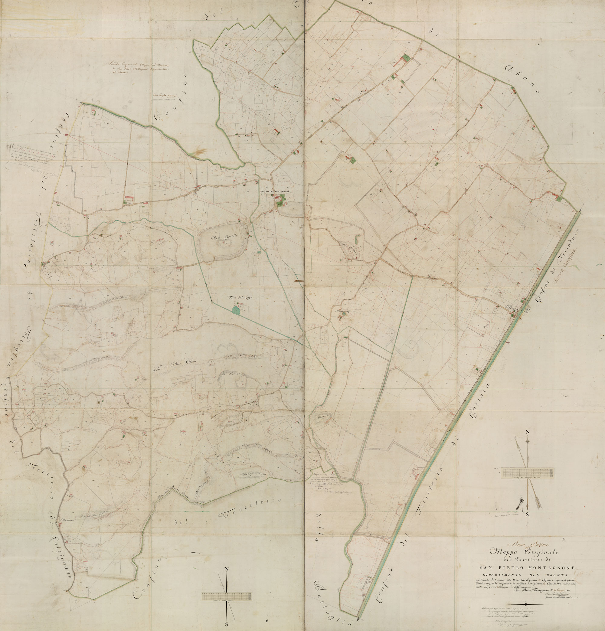
Cartographic dossier n°6CATASTO NAPOLEONICO – MAPPA DEL TERRITORIO DI SAN PIETRO MONTAGNONE, DIPARTIMENTO DEL BRENTA (1810)The Napoleonic Land Register, instrument devised by the French government for fiscal purposes, provided a first and detailed representation of the territorial organization: the map is based on accurate surveys, conducted by means of a vast and careful site measuring, while the drawing is done following officially approved scales. La riproduzione della mappa sottostante è stata eseguita dalla Sezione di fotoriproduzione dell’Archivio di Stato di Venezia ed è stata pubblicata con atto di concessione n. 51/2013 e Prot. n. 5802 del 01.08.2014.  Carta militare topografico-geometrica del Ducato di Venezia (1798 – 1805)… 
Mappa del Comune censuario di San Pietro Montagnone – Catasto austriaco (1834)… |
||
|
|
|||